

This is what the future of media looks like | Hamish McKenzie
-
What if the polarizing mess of social media, clickbait headlines and
addictive algorithms isn't a breakdown of media but a transition to
something better? ...
 click on image to see larger
I’m still working towards a specific sustainable design for my local neighbourhood, but before I can do that, I feel like I need to do some more thinking about how this neighbourhood could potentially fit into the surrounding urban fabric.
So for the plan you see above I’ve applied Steve Whitford’s Networks Cities principles in my design in a similar way to the approach used by BAU in some of their projects in China.
BAU’s approach is illustrated in the diagrams below, (taken from page 94 of Networks Cities). In the first diagram, program has been separated into three alternating bands –residential (yellow), commercial (red) and parkland (green).
 From Networks Cities (pg. 94)
click on image to see larger
It should be noted that the separate bands are not intended to be exclusive – that is to say – they are not zones like you would see in the “Ghetto City”; they’re closer to what planners would call ‘mixed use’. Whitford calls this approach “smooth programming” rather than zoning. And he uses the term 'smooth' in the Deleuzian sense, meaning something along the lines of 'full of potential'. The idea is that each of these bands would contain a concentration of one particular program (or culture or activity), but without excluding any other activity (except ‘dirty’ industry).
 From Networks Cities (pg. 94)
click on image to see larger
Open space x residential
Commercial x commercial
Commercial x open space
Commercial x residential
Residential x residential
Open space x open space
Commercial x commercial
Commercial x open space
Commercial x residential
Residential x residential
Open space x open space
One of the things I like about this design strategy is that by using a simple process with relatively few inputs - you can end up with very complex results. It’s making use of the natural phenomenon of emergence, where “complex systems and patterns arise out of a multiplicity of relatively simple interactions”. The designers job becomes to set up the interactions, observe their development, and then decide what to keep and what to discard. Like in film-making; a critical part of the creating the work is the editing process.
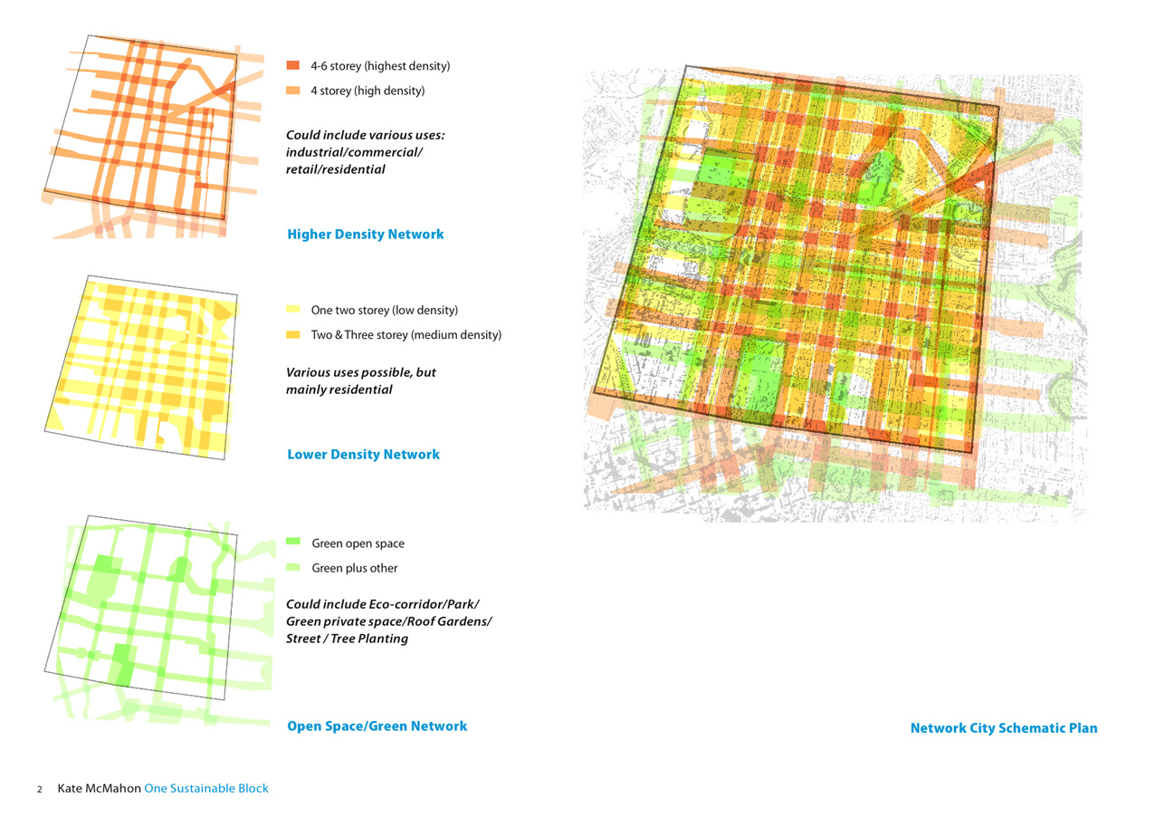
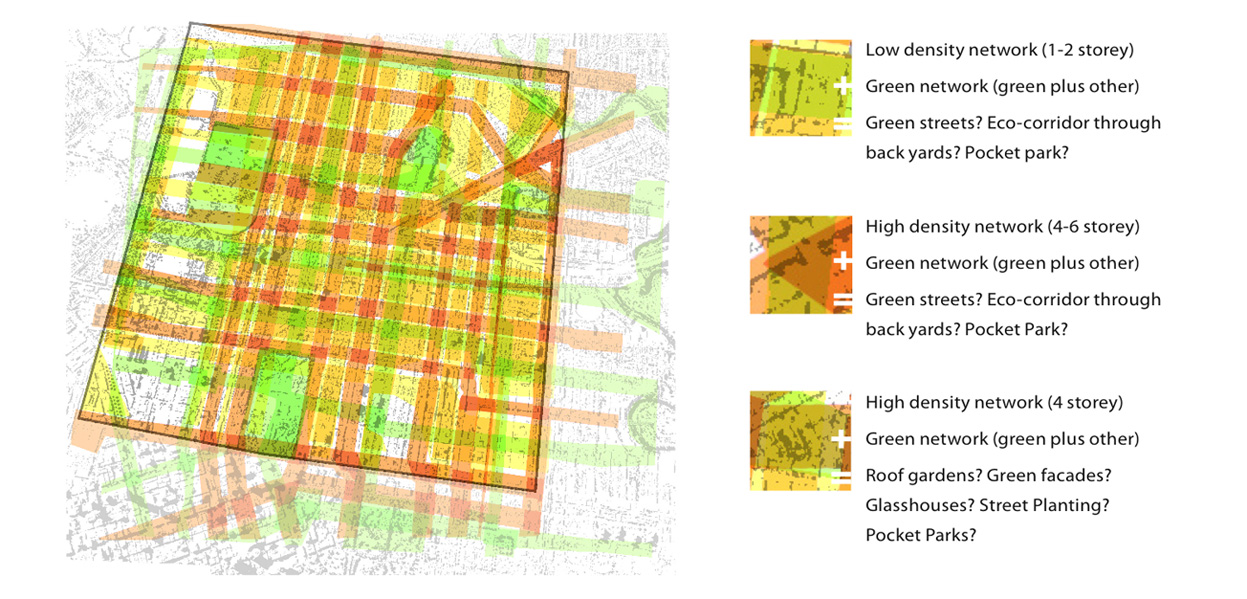
At the top of the post below is my attempt at a networks design for the Local Transport Area (the area shaded yellow here), like the BAU example I’ve broken up the programming into three bands:
- Low Density (mainly residential)
- Medium Density (commercial, retail, residential, industrial etc)
- Green Space (parks, street planting, eco-corridors etc)
And like the BAU example I've ended up with some interesting and/or areas, where seeming conflicting forms or programs are combined. What do you do if you get open space (green) and highest density (dark orange) 'crashed' together in the same place? Green facades? Roof gardens? High rise green houses?
I've located the bands according to existing conditions, for example, higher density along major road, green networks joining existing open spaces and low density in existing residential areas.
In the next post I'll look at what this process has turned up for my neighbourhood.
click on image to see larger
0 Comments:
Subscribe to:
Post Comments (Atom)